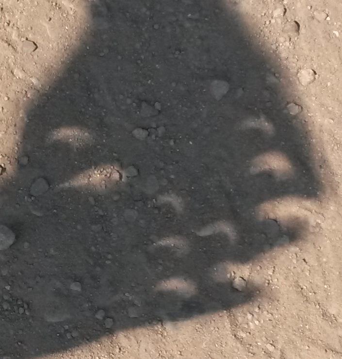
Images of the sun in the shadow of crossed hands
We sat back and waited for time to go. A few weeks before the trip, I started clicking around on the web, thinking about where we might plan to drive the morning of the eclipse. Uh oh! There was an incredible amount of scary planning by all the little towns on centerline! Were we screwed? Was I utterly stupid to get this lovely home rather than a crummy motel in totality? It was beginning to look that way. I'd invited my parents, so driving up the night before and sleeping in our cars (recommended by several websites) was simply not on the table. It was looking like we might miss this eclipse, despite anticipating it for 20 years.
I had my parents (who live in California) buy tons of food, get a couple jerry cans for extra gas, and drive up way early the day before the eclipse to make sure they'd get to the house. Because of kid camp schedules, we had no choice but to fly the previous day as well. When I went eclipse-hopping in both Antigua in 1998 and Hawaii in 1991, we had been able to arrive a few days before the eclipse, getting time to become ensconced in our accommodations, get the lay of the land, figure out where to actually view it, etc.
As a result, we were pretty concerned by all the dire warnings about a potential traffic apocalypse, since we had to drive from Portland on Sunday starting at 2pm. We were also getting pretty concerned about whether our rental car reservation would be honored when we arrived at the airport. Both of our earlier eclipse experiences were on islands, and there's a limit to how many people can get to an island. You can't just drive 500 miles the day before and plan to sleep in your car! So the idea of it taking 5 hours to get that 20-50 miles in the morning didn't seem out of the question.
When we arrived at the airport, there were signs saying "cars available" at the rental agencies, which was a big surprise. Our car was there! Hurray. Then, there was the question of "how to get to Bend". There are two options: south along I-5 and cross the mountains directly west of Bend, and east along I-84 and go south through Madras. Well, Madras was the place they about which were making the most dire traffic warnings. But the mountains west of Bend were full of wildfires and road closures!
In the end, we believed Google Traffic, and went through Madras. There were a few slowdowns, but it seemed that everyone had heeded the warnings to "get there early". It was interesting to drive through and see huge fields covered in tents. We should have stopped to buy tshirts, but we were worried about getting to Bend, not knowing if there was going to be a surprise hour-long delay somewhere along the line. In truth, we arrived in Bend without much additional delay, where my parents had dinner waiting for us.
Then the question was, how early to get up on Eclipse Day, and where to go? Clearly we weren't going all the way to centerline. But how far into totality could we get? It turns out that the graph of totality duration is shaped exactly like the moon's shadow, so it falls off very sharply at the edge, and thus you don't have to go very far to get a decent view. All the way to centerline is not necessary. This was cheering; we only needed to go 25 miles instead of 50. We bought a paper road atlas of Oregon, so we could find all the itty bitty roads between farms if needed, and if cell service was spotty.
We got on the road at 7 (totality at ~10:20), and headed north on route 97. We targeted Smith Rock State Park as our destination. Traffic was heavy but moving. We were glued to Google Traffic, the road atlas, and the eclipse app to tell us when we were getting close. We'd brought walkie-talkies that were good for about a mile, because we needed two cars for our group. On the way through Madras the preceding day, we heard other people on our channel, so we weren't the only ones thinking about cell interruptions, though in fact we never lost service. Just north of Redmond, we hit a fairly large traffic jam, and dodged it by going on some smaller roads to the east. So did a number of other people. As we approached Smith Rock, there were a huge number of people parked on the side of the road, and it seemed like getting into the park was not happening.
So we turned eastward again. Parked cars thinned out. We kept going a little longer, until the road started to turn south again, so we stopped where a dirt road intersected the main road. There was one other car on the dirt road already, and while we were waiting for the eclipse to start, a few more cars joined us. The eclipse app was very useful: it told us our location we had one minute and twenty seconds of totality, and exactly when it started. This was shy of the slightly over 2 minutes available in Madras, but by this time we were pretty excited to get to see anything at all.
We got set up before partiality began, and introduced ourselves to our neighbors. Everyone's there for the same reason, so they're all very friendly. People had a good time, and we let everyone use our binoculars (with solar filters) during partiality. I went around with my fingers crossed in the approved manner to make pinhole cameras, and there were some trees making crescent shapes. We didn't know about using a colander or a saltine for the job -- I saw those on the web later and thought they were totally cool. We also didn't have something to use as a screen onto which to project shadows, so the shapes were marred by the texture of the dirt road.
Unlike in my previous eclipses, which were on tropical islands, we had real "eclipse weather". It got downright cold in the last 10 minutes! The usual "thin light" effects; the kids' photogray glasses lightened up substantially as the moon ate more and more of the sun. I caught a glimpse of the diamond ring out of the corner of my eye as I was putting down my solar filter just as totality began. Lovely. I spent a few seconds looking through the binocs at some pink prominences. Then I spent a bit too much time worrying about other people getting a chance at the binocs, when I should have just been looking at the hole in the sky. I saw Venus; Ken says he saw Mercury through the binocs. We didn't have any wildlife effects, just it got cold, then dark with pretty corona, then light, then warmed back up. We weren't in a position to see the shadow sweep over the landscape, or to get much of the "sunset colors" effect at the horizon. But really, I should have been looking at the corona, not the horizon! It was over way too quickly. The good thing about 2024 is it'll be four minutes!
We didn't stick around for long after totality; one car headed back to the Bend house, and the other car headed to Prineville, where some friends of Ken's had viewed the eclipse. We hadn't planned to join them because Prineville is further from Bend, and they were really close to the shadow's edge and only had 25 seconds of totality. We had a nice visit, took a peek through the filters as the moon gave the sun its last kiss, and then rejoined our Bend contingent for the rest of the Oregon vacation.
Images of the sun in the shadow of crossed hands
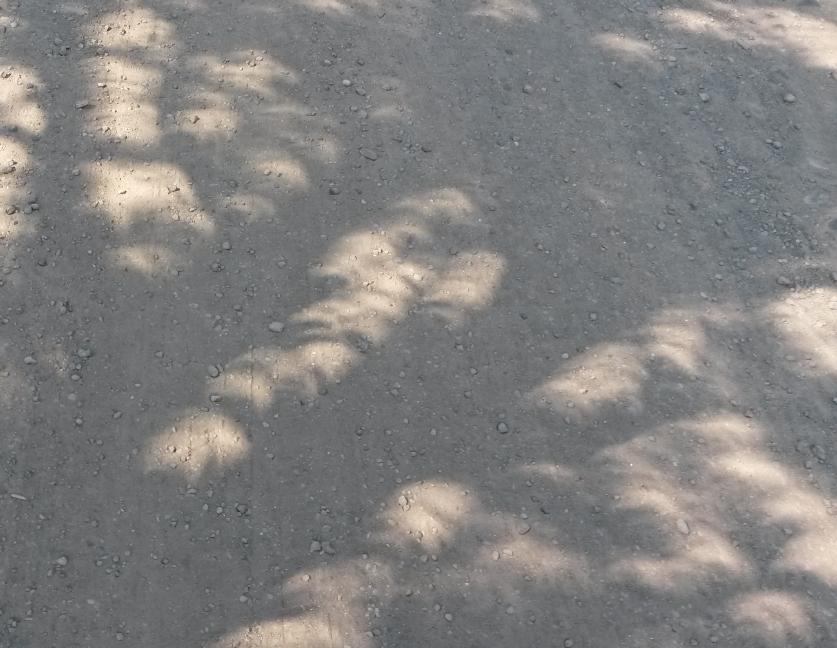
Images of the sun in the shadow of a tree
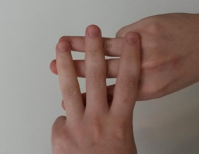
The pinhole camera hand cross