You can see the development of the game by looking at screenshots.
Click on the thumbnail to see a full size version.
| Date | Description |
|---|---|
 [1] [1]16 Apr 1995 |
At this point, there is simple terrain editing with the mouse: clicking takes you through road, water, farm, and clear tiles. |
 [2] [2]25 Jun 1995 |
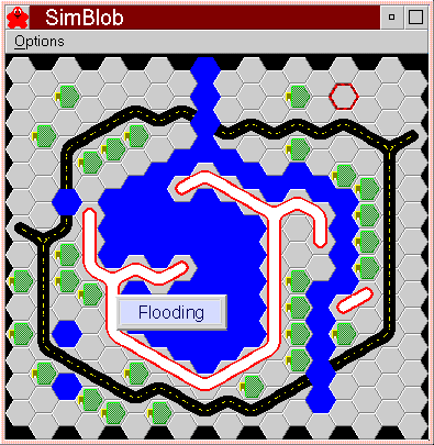
I have water flowing now. The top of the screen has high altitude and the bottom has low altitude, so water flows downwards. There is a spring at the middle of the top row that produces water. There are now walls (white and red objects) that block the flow of water. A message window shows “Flooding” but the game puts that there whether there’s flooding or not. |
 [3] [3]15 Jul 1995 |
The walls are now thinner and I’m using a different color scheme, but not much has changed. I was just testing SimBlob at 640x480 x 16M instead of the usual 1024x768x256 that I work in. |
 [4] [4]5 Aug 1995 |
Here we have layered terrain -- the first layer is grass, plains, hills, or mountains; the second layer is roads, farms, and walls; the third layer is water. |
 [5] [5]20 Nov 1995 |
Water is flowing down from the mountains (white) to the valley
(green);
there is a wall (gray) to keep it from getting to the area of farms
( |
 [6] [6]9 Mar 1996 |
There are many more levels of terrain, so you can more easily tell what the landscape is like. There is a blob soldier walking around too. |
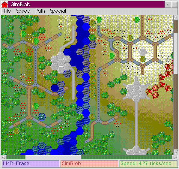
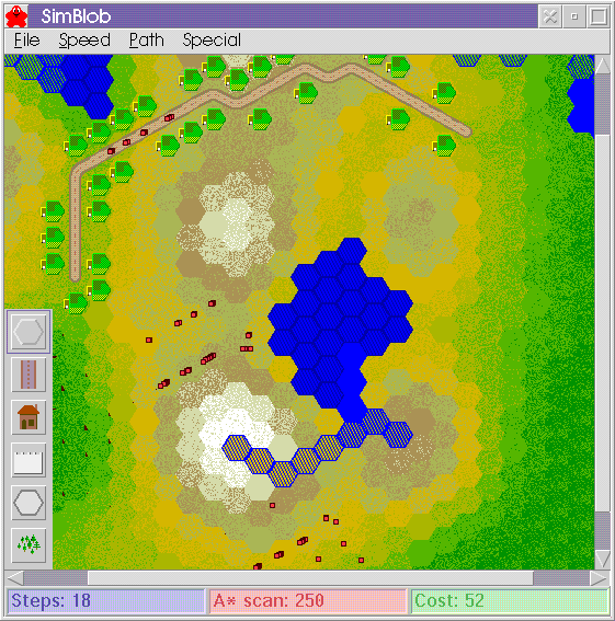 [7] [7]13 Apr 1996 |
The blob soldiers are now small red squares, and there are lots of them. There’s also a toolbar on the bottom left. The statusbar shows information about the path-finding algorithm, so that I can determine how good the path is. |
 [8] [8]21 Apr 1996 |
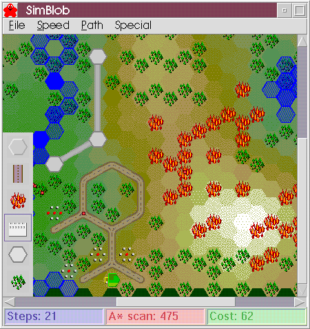
A fire is burning in the forest on the right side, and a town is starting in the lower left. A few blob soldiers are walking around. |
 [9] [9]10 May 1996 |
A river flows down the center of the window; on the left of it is a wall keeping some of the water from flowing out into the town on the left. There is a fire near the town on the right. |
 [10] [10]26 May 1996 |
The new water graphics don’t show depth but are rounder around the edges. New wall, farm, and house graphics have a slightly textured look. A fire is burning the town on the left side, and several blob soldiers are there but don’t help put out the fire. |
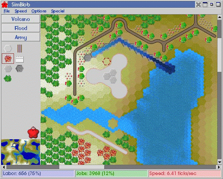
 [11] [11]1 Jun 1996 |
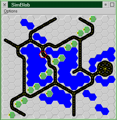
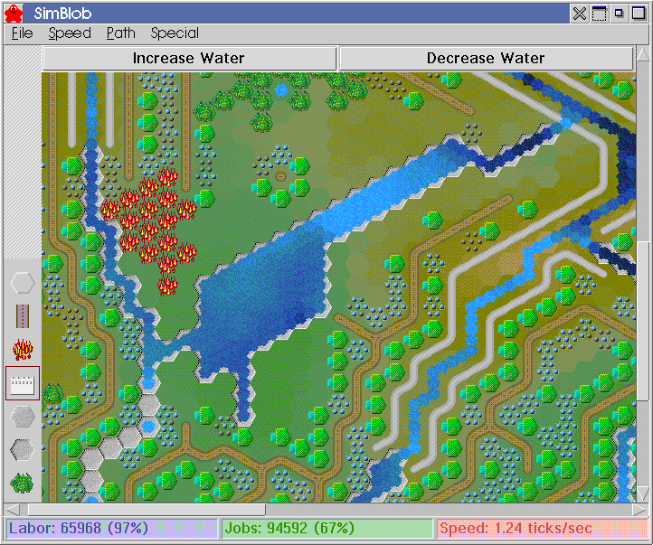
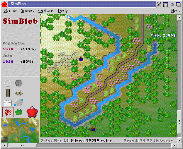
There is an artificial lake in the center, being fed by water spilling over a wall near the top right corner. On the left is an artificial waterway set up to bring water to farms. There is also a fire burning some of the farms. The status bar shows that 97% of the sixty six thousand people are working, and 67% of the ninety four and a half thousand jobs are filled. |
 [12] [12]15 Jun 1996 |
There is an artificial lake in the lower left corner, being fed by water source off the left side of the screen. A fire is burning on the right side, and there are lots of blobs walking around. The status bar shows that 94% of the sixteen hundred people are working, and 39% of the nearly four thousand jobs are filled. |
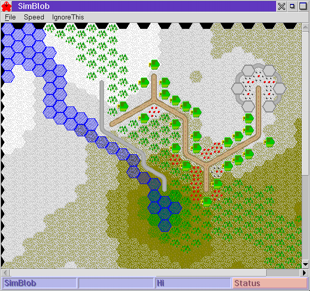
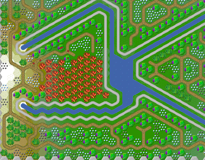
 [13] [13]12 Jul 1996 |
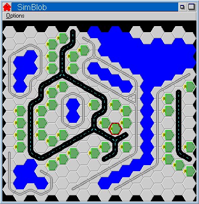
There is a river starting on the let that feeds a lake on the right. A forest on the bottom left is going up in flames, and there is a wall there to keep the fire from spreading to the trees by the river. At the top of the window, there are many houses and farms by the road. A canal draws water from the lake to the farms. A fortress is near the center of the screen. |
 [14] [14]30 Jul 1996 |
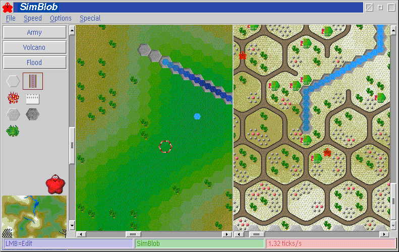
This screen shot shows a split screen view that allows you to see two
areas of the map at once. It also shows what SimBlob looks like under
Merlin. Note: This version was lost in a hard disk crash; I no longer have the split screen or DIVE code. |
 [15] [15]12 Oct 1996 |
(This is the first screenshot since the crash.) |
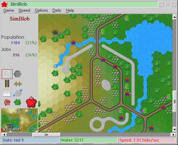
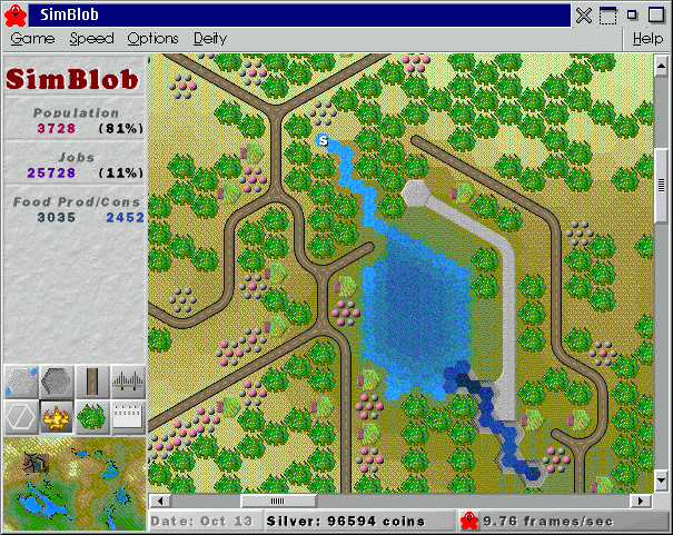
 [16] [16]22 Oct 1996 |
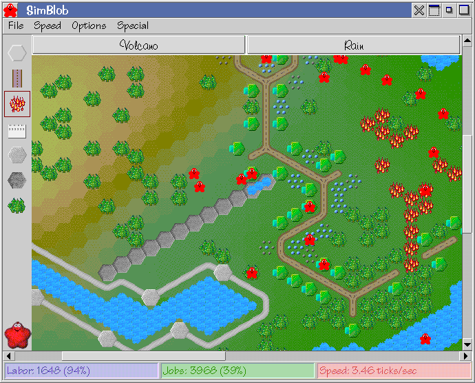
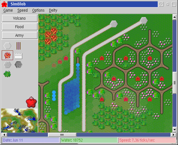
A volcanic eruption has left forest fires on the left side of the
screen. There is a river flowing from the bottom left to the top
right, and a town is next to the river. There is a wall to protect
the town from floods. The population and number of jobs available are
shown on the left. The percentages next to those numbers are the
number of people employed and the number of jobs filled,
respectively.
|
 [17] [17]21 Nov 1996 |
Several blobbuilders are walking around, wearing overalls. There is a small community between the two rivers; it is protected by walls that keep the rivers from changing their course and entering the village. Bridges lead out and over the rivers. |
 [18] [18]26 Dec 1996 |
A fire is burning some of the forest; a small town is growing near the river. |
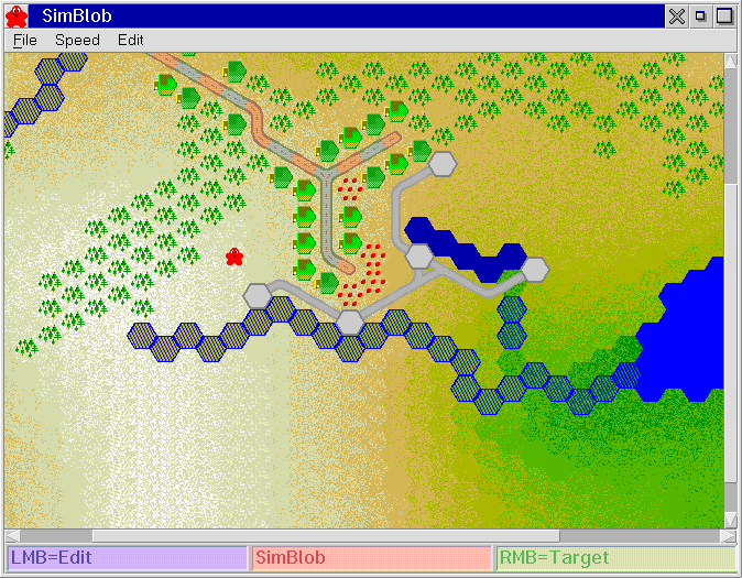
 [19] [19]9 Jan 1997 |
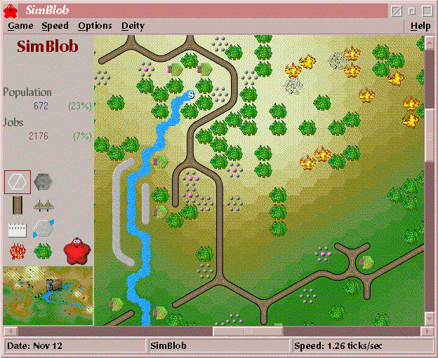
A group of people have built their “town” along a single road surrounded by canals. The new display system can be seen here: the ‘ticks’ value is text overlaid on top of the map; the statusbar and information area (on the top left) are textured and anti-aliased. |
 [20] [20]30 Mar 1997 |
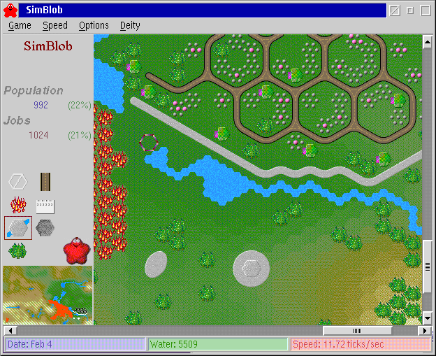
A town has started near the river. This town is the result of auto-build mode, which builds both roads and houses, but in normal play, only houses are automatically built; roads are built manually. (Auto-build mode will be used for the computer player.) Slightly below the center of the window, you can see the spiral cursor. |
 [21] [21]13 Apr 1997 |
In this screenshot you can see the new look for the toolbar. This toolbar uses my graphics routines rather than OS/2’s graphics routines. In addition to the graphics, the toolbar allows me to change mouse pointers when different tools are selected. |
 [22] [22]11 May 1997 |
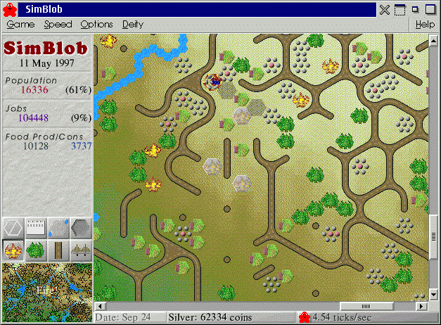
In this screenshot you can see the new fonts. Also, the terrain
graphics are much smoother. To the left of the middle of the map you
can see three structures that have a faint fire on top; these are the
new watchtowers. When a fire is detected, the watchtower sends out a
firefighter (who can be seen under the cursor).
(And yes, I know it’s an old screenshot, but the display hasn’t changed much. I’ve been working more on internal structure and simulation.) |
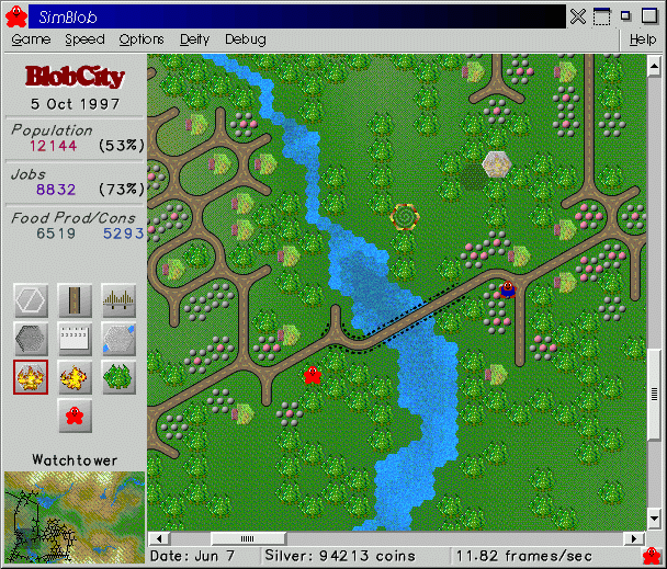 [23] [23]5 Oct 1997 |
Here you can see the simpler interface (no background texture, simple red line around the current tool), a help area that shows you what the current tool is, the two kinds of blobs (firefighter wearing overalls, and the all-purpose blob), and a new, free font (Hershey-Plain). |
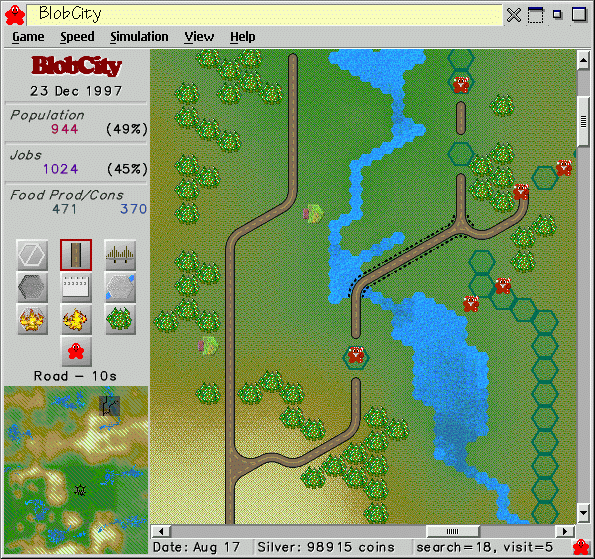 [24] [24]23 Dec 1997 |
Blobs now build everything except walls and fires. When you want something built, it gets highlighted with black hexes, and that is where the blobs will go. If a blob is planning to build on a hex, the hex turns green. You can also see the “Christmas” graphics here (Santa Blobs and Christmas Trees). |
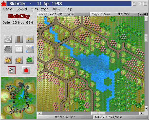 [25] [25]11 Apr 1998 |
In addition to a status bar there is a bar across the top that has information (Silver and Population for now, but Selected Object will be added later). The Population and Speed buttons can be clicked to cycle through other displays, such as Food and Jobs. The screenshot does not show the mouse pointer, which is pointing to some water in the middle of the screen; in the status bar you can see the water depth for the pointer location. |
 [26] [26]5 Jul 1998 |
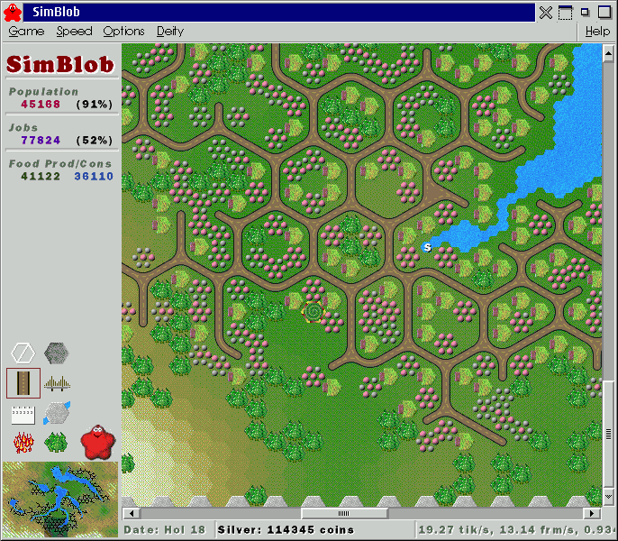
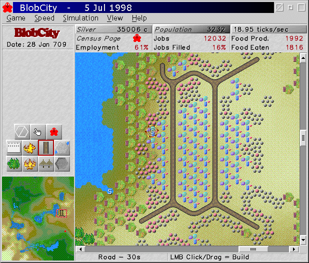
At the top of the window are three buttons (Silver, Population, Ticks/Sec) that control what information is showed underneath the button bar. In this screenshot you can see the new structure of the city: markets in the center, surrounded by houses, with farms at the edge of the city. |
 [27] [27]9 Aug 1998 |
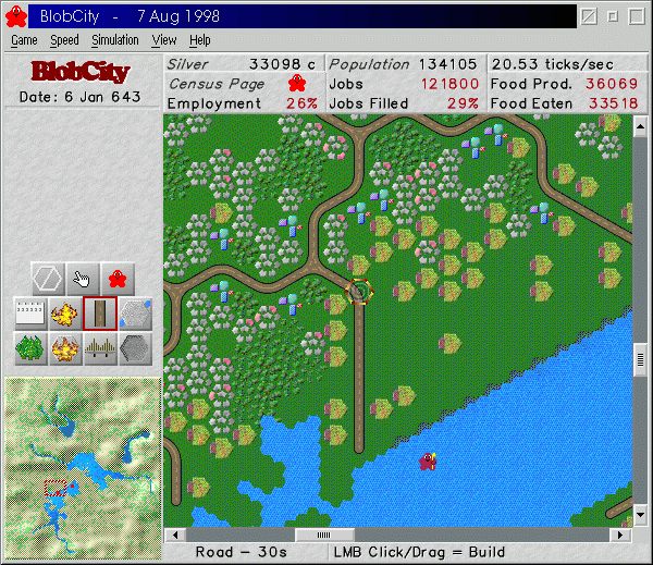
On the map you can see the new house bitmaps (shaded polygons, rather than spheres) and new tree bitmaps (overhead view rather than side view) that show age (size) and season (color shading). At the top of the window the buttons (Silver, Population, and Ticks/Sec) now look like tabs for the information area below them. Although you can’t see it here, if you move the mouse over the tab button, that tab’s page will light up. In the bottom left corner you can see a new shaded world map. This view allows you to get a better idea of the terrain. Another new view for the world map is the Civilization View (not shown), which filters out the terrain and shows you the details of your civilization (farms, markets, houses, roads, walls, etc.) |